The Future of Surveying: An In-Depth Look at Drone 3D Mapping
This innovative technique is transforming how we gather, analyze,... In this blog, we will explore the ins and outs of drone 3D mapping, its benefits,...
In recent years, drone technology has revolutionized various industries, from agriculture to construction. One of the most exciting applications of drones is their ability to perform 3D mapping. This innovative technique is transforming how we gather, analyze, and present data. In this blog, we will explore the ins and outs of drone 3D mapping, its benefits, and how it is reshaping industries.
What is Drone 3D Mapping?
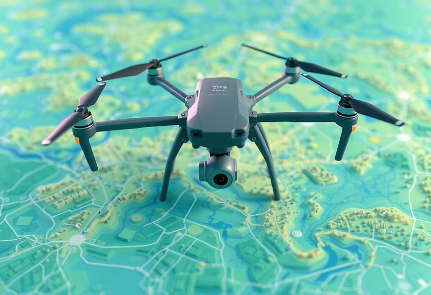
Drone 3D mapping refers to the process of capturing aerial images using drones equipped with high-resolution cameras and LIDAR (Light Detection and Ranging) technology. These images are then processed and transformed into detailed 3D models or maps. The accuracy and speed of data collection make drone 3D mapping an attractive option for professionals looking to create topographic maps, site plans, and other forms of geographical data visualization.
How Does It Work?
The process begins with a drone flying over a designated area. Using advanced GPS and imaging technology, the drone captures thousands of images from different angles. These images are stitched together using specialized software to create a three-dimensional representation of the landscape. The flight path, altitude, and overlap of images are key factors that influence the quality and accuracy of the resulting 3D map.
Applications of Drone 3D Mapping
1. Construction and Infrastructure
In the construction industry, drone 3D mapping is employed to create detailed site surveys that help with project planning and management. By providing accurate models of existing terrain and structures, project managers can make informed decisions and mitigate risks before construction begins. Tracking progress and comparing it against the initial plans is also easier with regular drone surveys.
2. Agriculture
Farmers and agronomists are increasingly using drone 3D mapping to analyze crop health, monitor irrigation systems, and assess pest damage. High-resolution 3D maps allow for precise monitoring of fields, enabling better-targeted interventions and ultimately leading to improved yields.
3. Mining and Quarrying
Mining operations benefit significantly from drone 3D mapping. It is used to assess mineral distribution, create volumetric estimations, and monitor environmental impact. Drones can survey large areas in a fraction of the time it would take using traditional methods, providing valuable information to guide mining activities.
4. Environmental Monitoring
Drone 3D mapping is employed in conservation efforts, allowing researchers to monitor changes in ecosystems, track wildlife movements, and assess the impact of climate change. This technology provides essential data for protecting natural resources and promoting sustainability.
Benefits of Drone 3D Mapping
1. Cost-Effective
Traditional surveying methods often involve high labor costs and lengthy projects. Drone 3D mapping drastically reduces these expenses by automating the data collection process.
2. Time Efficiency
With drones, vast areas can be mapped in a fraction of the time required for ground surveys. This speed allows for quicker decision-making and project turnaround.
3. High Accuracy
The precision of drone technology offers extremely accurate results that can be critical for industries that rely on precise geographical data.
4. Versatility
Drone 3D mapping can be used in various environments and sectors, from rugged terrains to urban landscapes. This versatility makes it a go-to tool across different industries.
The Technology Behind Drone 3D Mapping
The success of drone 3D mapping lies in the technology behind it. Drones equipped with RGB cameras capture visual data, while LIDAR sensors offer additional accuracy by mapping the precise location of ground points. The data collected is processed using Geographic Information Systems (GIS) software to create detailed models and maps.
Challenges and Considerations
While drone 3D mapping offers numerous advantages, there are also challenges to consider. Regulations regarding drone flights can vary by location, often requiring permits for operation. Additionally, weather conditions can affect the quality of the images captured, making planning crucial.
Conclusion
As industries continue to embrace technology, drone 3D mapping stands out as a powerful tool for data collection and analysis. Its ability to provide accurate, cost-effective, and timely information is making it an invaluable asset across various fields, from agriculture to environmental monitoring.
FAQs about Drone 3D Mapping
Q1: What type of drones are used for 3D mapping?
A1: Drones equipped with high-resolution cameras or LIDAR sensors are commonly used for 3D mapping. Some popular models include the DJI Phantom, Mavic series, and specialized LIDAR drones.
Q2: How long does it take to create a 3D map using drones?
A2: The time varies based on the area being mapped and the complexity of the data. However, aerial surveys using drones can be completed in hours, whereas traditional methods may take several days.
Q3: Is drone 3D mapping suitable for small-scale projects?
A3: Yes, drone 3D mapping can be effective for both large and small projects. It can provide valuable insights for small construction sites or individual agricultural fields.
Q4: What software is typically used in processing drone imagery for 3D mapping?
A4: Common software options include Pix4D, Agisoft Metashape, and DroneDeploy. These programs help stitch images together and create 3D models.
Q5: Are there any regulations on using drones for mapping?
A5: Yes, regulations vary by country and region. It’s essential to check local laws regarding the use of drones for commercial purposes, including licensing and airspace restrictions.
In conclusion, as technology continues to advance, drone 3D mapping is likely to become an even more integral part of various industries. Its benefits are clear, and understanding how to leverage this technology will be essential in maintaining competitiveness and efficiency in the market.
Why James Deller Believes Culture Drives Long-Term Performance
Why James Deller Believes Culture Drives Long-Term Performance